Torri del Benaco Ring
Starting point Path n. 41 at Monte Pomo
Ending point Path n. 41 at Monte Pomo
Difficulty E
Distance 16640m
Average slope 5%
Maximum slope 24%
Uphill \ descent difference in height 300m\260mm
Altitude min 122m
max 494m
Terrain types Footpath, paved mule track, dirt road, asphalted road

Non gettare rifiuti

Non raccogliere fiori

Scorta d'acqua e di cibo
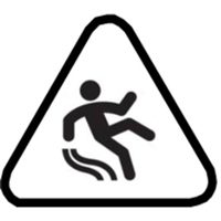
Fondo scivoloso
This spectacular ring can be walked in both directions.
The start is located in the valley between Monte Bre and Monte Pomo, just north of Punta San Vigilio (trail sign no. 41). The itinerary, which takes up a whole day, crosses the coast, with gentle ups and downs among the olive groves, of Torri and the districts of Loncrino and Coi up to the typical village of Crero.
For the return you can go up towards San Zeno di Montagna, continue towards Albisano (splendid balcony over the lake) and proceed towards the Sorte, under Monte Luppia, descending to the starting point. Along the descent, west of Mount Are, you can see the rock engravings, in what must have been a place of worship in ancient times.
